tv NBC Nightly News NBC October 29, 2012 6:30pm-7:00pm EDT
6:30 pm
resources. when something happens, they can deploy people write to that and everybodynt, is taking like a dinner break. a much-needed one. >> i know hurricanes sandy can potentially impact 50 million to 60 million people. >> and the federal government is absolutely shut down in washington, d.c., and sally kidd is there looking at a response. >> throughout the afternoon in washington, there is a bit of traffic. for the most part, people are heading indoors. conditions are expected to deteriorate rapidly. president obama received a briefing on the storm. >> president obama scrap his campaign plans and flew back to
6:31 pm
washington to deal with superstorminess sandy. this will be a big and powerful storm. >> state and local officials. >> if you need to evacuate, you need to evacuate. do not pause. do not question. this is a serious storm. >> homeland securities jenna nicole itano looked at all the resources at their command. there are fema supplies in response teams up and down the coast. >> that means moving teams in from other parts of the country that they can immediately get in to help with the recovery and response. >> the advancing storm of battle the towns in new jersey and new york. the stock exchange is also shut
6:32 pm
down. workers were told to stay home. on the national mall, one person get in one more run before the worst crimes. >> so far, it is not that bad yet. >> they have canceled flights. passengers have been stranded. they have been told to stay inside and stay safe. reporting from washington, sally wbal tv 11 news. >> enough money to fund disaster assistance right now, but the administrator says they will be needing additional funding. this is very, very expensive.
6:33 pm
>> the damage will range, as you mentioned earlier, between $10 billion and $20 billion, with a b, and that would make sandy among the most expensive. hurricane katrina, the price tag $108 billion. yes, and that was just in money terms, not in people terms. >> right now, we are going to go back to baltimore. are things getting worse? >> things are getting worse. people have been talking about this storm. is worse than it was last year, with i read, for example. we are dealing with some really cold temperatures. not only with the reagan, looking at the rain falling at a lamppost, i will tell you what.
6:34 pm
these winds have continued to pick up in the last hour. i want to give you a bit of detail. 311 is fully operational. they are asking you to call 311 if you have a cottage. -- an outage. we have got 2000 police officers. also, swift water rescue is in place. we do know that these conditions are going to get worse. we also know that housing inspectors are out and about. wherever you are right now, do
6:35 pm
6:36 pm
>> and they were talking about preferring to use texting. a lot of times, you cannot get a takes a lot, but it less power and a lot less space, i suppose, to send a text, so if you can do that, do that instead of a phone call. on the way to work this afternoon, in this era of texting and cell phones, in order to conserve energy in the event that we lose power, turned the brightness down. make sure you close out the phone soons on your you can have your cell phone ready. if you need to call, you will not be able to plug-in because you have lost power. that is a way to conserve energy on your cell phone. >> our live and continuing coverage of hurricane city continues in just a moment.
6:40 pm
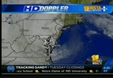
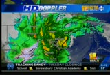
coverage of the hurricane. thank you for staying with us. we will check in with our chief meteorologist tom tasselmyer. >> it looks like it is pushing close to onshore. here we are at 20 minutes until 7:00. it looks like the heaviest rain bands, are moving on shore. if this satellite imagery is as the storm system begins to push inland, not a really big center core at least that we can see on the satellite imagery. there is some circulation on the south jersey shore. perhaps getting close to landfall, and the potential of this hurricane to be pretty close to the crows. if not already moving on shore. maybe tending to drift a little north in the last hour or so. we just have to kind of wait and
6:41 pm
see if it gets further. at any rate, it is still raining heavily, an hour rainfall totals continued to climb, while there is no fault in the western part of the state. there is significant rain to go. a 90 mile per hour wind hurricane. it will be gusting at times and probably is slowly diminish during the day tomorrow. the winds are coming in across land, going into the center of this storm. tomorrow, as it gets into the mountains or pennsylvania, a wind shift is something we will have to factor in. all of that is still in play. right now, it is just wind and rain. taking a look at the current
6:42 pm
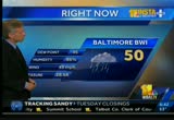
observations at the airport. the barometer. the lowest barometer has ever been in baltimore, 28.52 inches. that was set during the blizzard of 1993. march 13, 1993, at the airport, the barometer dropped. we are almost there. we are almost at the all-time record low barometer. the lower the barometer, the lower -- the worst the storm. i think the pressure is going to continue to fall. we could set a record for the lowest barometer. the winds are gusting at the airport with a temperature of just 50 degrees and moderate them a heavy rain. this is what we are looking at for the center of this storm. the winds are light at the center, and the stronger winds are being pushed back inland in our direction. as the center of the storm moves, we continue to see this.
6:43 pm
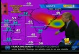
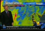
strong gusts heading out into the atlantic, gusting to 56 delaware, and the key bridge now with a 54 mile per hour gusts. at the airport, gusting over 50. thomas point, look at that. this is just off the coast of anne arundel county. guesting to 49 in salisbury. ocean city, those winds have been becoming northwesterly. remember, the winds blow into the center of low pressure, so now out at ocean city, we are starting to get more of this, and that a wind shift will be significant. this is into the day tomorrow. these are the wind speed forecasts. we are generally talking 50 mile per hour winds. this pushes inland as the center of the storm moves. this is parts of the cecil
6:44 pm
county, south central pennsylvania, these areas, and they are expecting to get a lot of wins, the same thing all along the bay. southern pennsylvania, probably closer to our maryland line, the strong wind will be pushed in. they have heavy snow in the mountains. our winds will start shifting to the south as we get into tomorrow morning. we will still have some strong wind gusts. in the 30's to 40's, pushing water up the bay. the highs on the bay are likely be worse than they were today, simply because of a change in the wind direction. 11:00 in the morning, this is from north to south on the bay. this will arrive at st. michael's as early as 5:00 in the morning. above normal. above normal tides tomorrow.
6:45 pm
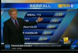
probably for the afternoon tide as well. this is a precipitation estimate from radar around the region. the intensity of the rain and how much fell. you can see this is very heavy, the eastern shore down to the lower part of the bay. we are talking maybe 11 inches of rain. that does not mean every rain gauge picked up that much. we have already have upwards of 8 inches, 9 inches, 10 inches, 11 inches. in one area, the rain was coming down yesterday. it is still coming down. over four inches at bwi marshall for the total. the inner harbor, over four. approaching 7 inches of rain over here. it is just getting onshore in new jersey. additional rainfall. take what we have gotten and add to it. as we go through the next days, this shaded area is where another 5 inches of rain can
6:46 pm
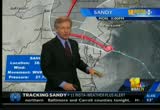
come down. there is another 7 inches of rain. this is in south-central pennsylvania. generally speaking, we have had four to 6 inches of rain. we could end up with another four inches or 5 inches on top of that. onshore in southern new jersey, pushing in into delaware and the northern part of the bay. taking it pretty quickly. the momentum is more on a westerly track. it looks like perhaps the center of the storm goes across cecil county, maybe getting into the catoctin. this is looking at the way unfolded over the last few hours. this is the official national center track. do not look at the center line. this is the range of possibilities. right now, the southern part to me at least looks more likely.
6:47 pm
we will see. at the center of the storm, the barometer is at 27 plus some. we could well go below and set a the lowest barometric pressure reading. this is moving in. so are the heavy rains, which would change to heavy snow in the mountains. showers continue into our region. moderate them a heavy rain, gradually tapering off to more scattered showers tomorrow. this time, coming out of the south tomorrow afternoon. the tides in the bay are going to be slowed to recede. they will be higher than normal tomorrow because of that wind. this is going into hallion and even into thursday. but for the trick-or-treaters, hang in there. like the reign will end early in the morning and then it will be cloudy, breezy, and chilly. tonight then, temperatures in the 40's, some periods of rain,
6:48 pm
and then tomorrow, temperatures steady or even falling. it will slowly diminish into the afternoon, gusting at over 40 miles per hour. the highs stayed below normal for the next several days. lows in the 30's. >> thanks. in the last minutes, there has been a spike. we go live to the newsroom with the very latest. things have jumped exponentially, jumping by 20,000 in just a 10-minute period. we want to update you on the situation as we speak. 85,000 people are without power
6:49 pm
6:50 pm
when the winds started exceeding 25 m.p.h., they have to be at a safeway in point until they can restore. i do not know if they can say of the restoration is over, but there are windows of opportunity. 85,000 without power right now. we have gotten some interesting facebook comments. lwoell -- lowell is fine, and his photographer is fine.
6:51 pm
some folks just lost power. all is well in carroll county. at least in that particular neighborhood. a big dust in owings mills. fingers are crossed there. very windy in northeast baltimore. there is a stronger wind gusts in catonsville. another viewer sent us a picture of a very flooded backyard in the hillside road area, so that is the situation as we speak. clearly as the storm ships, so does the power outage story. if you thought maybe you would escape this one, i think we will all be feeling this one in the next hours when it comes to power. >> i remember when they said that. >> it was a wincing. >> it could certainly happen. >> early in the afternoon before the wind started picking up, they were able to restore power
6:52 pm
6:53 pm
it varies in intensity. there was a band of rain coming down about two minutes ago, and it felt like you were under a waterfall. now, it is less in intensity. sustained winds this afternoon. the national weather service was clocking about 35 miles per hour for a period of time. the gusts were absolutely ridiculous. we did not add anything to measure them with, but trust me. it was pretty intense. it is still going to become even more ugly. reporting live, david collins, wbal tv 11 news. >> they are now nearing 700,000 people in new jersey that are without power. we know that will take weeks, possibly weeks to get all of that restored. >> that happens very quickly. as soon as city enclosed to it hitting landfall, that 700,000 figure happened really quickly.
6:54 pm
6:55 pm
>> we hope we did not drive you nuts. >> i am not going there. >> be careful if you go out tonight. do not go out if you do not have to. rob roblin, wbal tv 11 news. >> some people are having fun. some hurricane parties. i do not think i have seen anyone else have one. stay with us. live continuing coverage of hurricane city continues in just a moment.
6:56 pm
it's oysternomics 101. you start with a u.s. senator named ben. by helping restore thousands of acres of oyster beds, he kept hundreds of oystermen on the job... which keeps wholesalers in business... and that means more delivery companies... making deliveries to more restaurants... which hire more workers. and that means more oystermen. it's like he's out here with us. he's my friend, ben. i hope he's your friend, too. i'm ben cardin, and i approved this message.
6:58 pm
6:59 pm
the evening moves on, you see the served getting more and more dangerous. that is the latest in notion city. >> people are concerned. it is very tough for. >> some of our crews have been going since early this morning. >> i was looking at those areas. he is really feeling it there in the mouth of the eastern shore. we want to give him a break and check back with a mill that later. -- with him a little bit later. this was taken earlier today when we still had light in when we still had light in elders bird
256 Views
IN COLLECTIONS
WBAL (NBC) Television Archive
  Television Archive News Search Service
Uploaded by TV Archive on

 Live Music Archive
 Librivox Free Audio
 Metropolitan Museum
 Cleveland Museum of Art
 Internet Arcade
 Console Living Room
 Books to Borrow
 Open Library
 TV News
 Understanding 9/11